|
||||||
|
|||||||
|
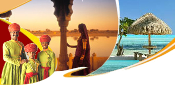
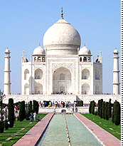
Book Online travel india, the land offering diverse travel opportunities, ranging from travelling through the himalayas to the kanyakumari. taj mahal, khajuraho, goa and kerala backwaters are some favourite rendezvous for travelling in india. opt for cultural, heritage or an adventure travel of india and make your travel experience in india a lifelong memory. |
Lakshadwdweep AnglingAgatti Location : 10° - 51* latitude 72° - 11* longitude, located 459 Kms from Cochin. 6 Kms long & 100 mtrs wide. Climate : Hot. In Agatti, coral growths & multi coloured coral fishes abound in its lagoons. The climate of the island is hot when compared to the islands in the rest of the group. Fishing is the most important industary of Agatti which is perhaps the only island besides Minicoy getting surplus fish. Next to fishing, coir & copra are the main industries. Agatti is the airport stopover from Cochin & Goa on the way to Bangaram which can be seen on the northern horizon. Agatti offers fully furnished resorts managed by a private entrepreneur. The main attraction at the resorts is the water sport facilities. A medical centre with qualified doctors functions at Agatti. Andrott Location: 10° - 49* North latitude 73° - 41* East longitude, located 293 Kms from Cochin.Andrott is the nearest island to the mainland & has an east-west orientation unlike other lying in the north-south direction. It is the largest island in Lakshadweep, Thick vegetation, mainly coconut groves, add to the beauty of the island. It was the first island to embrace Islam. The Saint Ubaidullah, who is believed to have converted the people of the islands into Islam, died here & his tomb still remains in the Juma'ath Mosque. Religious prechers from here are held in high esteem. Fishing indusatry is well develope , next only to Minicoy & Agatti. Coir & Copra are the major products of the island. Amini Location : 11° -071* north latitude 72° - 44* east longitude, located 407 Kms from Cochin. Land Area : It is 3 Kms. long & 1.5 Kms. wide with ablong shape. Coral sand stone is used for building purpose. Talented craftsmen living here are famous for making walking with tortoise shells & coconut shells. It's also famous for stone engravers & has a rich tradition of folk songs. The island got its name from the Arabic word ' Amini ' meaning "faithful". Bangaram Location : 10° - 56* latitude 72° - 17* longitude, located 459 Kms from Cochin. Climate : Warm round the year. Rainfall is limited & the temparature duringmonsoon is 25-27° C. A bewitchingly beautiful & breathtaking island in the Lakshadweep, Bangaram is un-inhabited. It is surrounded by a shallow lagoon enclosed by coral reef. It has been ranked among th ebest getawyas of the world. Here the sun, sand & surf in harmony casting a spell on the visitor. It offers utmost privacy unpolluted comfort with crystal clear water. Sparking coral reef & blue lagoon perform magic on the soul searching traveller. It's a place where a Hemingway would create a classic or a Van Gogh would paint a mastrepiece. And who knows the muse may inspire one to create too. A matchless sense of well being takes over & one begins to discover the graceful fishes, porcupines, parrots, pufferfishes, hermit crabs & sea birds on the vast 120 acres of lush coconut groves in Bangaram. Bitra Location : 11° - 36* North latitude 72° - 10* East longitude, located 483 Kms from Cochin.Bitra is the smallest inhabited island in the territory. Till 1835 Bitra was the breeding ground for a number of seabirds, a favorite haunt of Kiltan & Chetlat people. There is a small shrine of Malik Mulla, an old Arsb Saint who is said to have been buried here.The shrine is a place of pilgrimage for the people of other islands. Surprisingly the first permanent settler at Bitra was a woman from Chetlat who with her son set up a permanent house around 1945. Chetlat Location : 11° - 41* North latitude 72° - 43* East longitude, located 432 Kms from Cochin. Chetlat is the northern most inhabited island. Coir twisting is the chief occupoation of the people here. The coconut yield is poor & income is mearge. Manufacture of mats & weaving of coconut leaves are spare time industries here. The island suffered a great dea at the hands of the Portuguese in the 16 th century. Boat building was a flourishing industry at the beginning of the century when all the vessels needed by the Amindivi islanders were built here. Kadmat Location : 11° - 13* latitude 72° - 47* East longitude, located 407 Kms from Cochin. Land Area : 8 Kms. long & 550 mtres at the broadest point. It has a very large lagoon on the western side with abundent coral growth. Long sandy beaches & excellent water sport facilities are the stellar attractions here. Main occupation of the people is coir twisting. It is famous for its lime stones used for building purposes. In addition to the beautiful shallow lagoon on the west that forms an ideal spot for water sport, there is narrow lagoon on the east. Kalpeni Location : 10° - 05* North latitude 73° - 39* East longitude, located 287 Kms from Cochin. It also known for its scenic beauty & the small Tilakam & Pitti & an uninhabited island on the north called Cheriyam. A huge shallow lagoon encloses all of them. A peculiar feature of Kalpeni atoll is the huge storm bank of coral debris along the eastern & south-eastern shorelines. It is believed that huge boulders were thrown up during a storm in 1847. It is a progressive island. It was in this island girls first went to school. Water sport crafts are given on hire; two bathing huts with change-rooms are avaible. Kavarati Location : 10° - 33* North latitude 72° - 38* East longitude, located 404 Kms from Cochin. It is the headquarters of the U.T. Administration since 1964. You have enough time explore the island. The beautiful calm lagoon forms an ideal spot for water sports, swimming & basking on warm sandy beaches.Marine life exhibits can be seen at the new marine aquarium which has excellent collection os spcimens. The Dolphin Dive Centre is another attraction for watre sports enthausaists. Kiltan Location : 11° - 29* North latitude 73° - 04* East longitude, located 394 Kms from Cochin. Kiltan lies 51 Kms.north-east of Amini on the international trade route between the Persian Gulf & Sri Lanka. The island is only 3 Kms. long. On the northern & southern ends of the island there is a high storm beach. The island is thick in flora & is fertile. The summer nights in Kiltan are warmer & it is usual for the people to sleep outside their homes, on the beaches. Kiltan has a rich tradition of folk dances. Minicoy Location : 8° - 17* North latitude 73° - 04* East longitude, located 398 Kms from Cochin. It is about 10.6 Kms. long; it is the second largest island, the first being Andrott. It is the southern most island in Lakshadweep, crescent shaped & has one of the largest lagoons. Viringili is the small islet that can be seen on the south. Minicoy is set apart from the northern group of islands by its culture; the islanders are employed as seamen in ocean going vessels the world over. Traditionally all powers to manage village affairs are vested in him. Each village has a village house beautifully decorated & Maintained. |
 |
Destinations in India
|
Holidays in India
|
India Tour Packages
|
||